 |
|
|
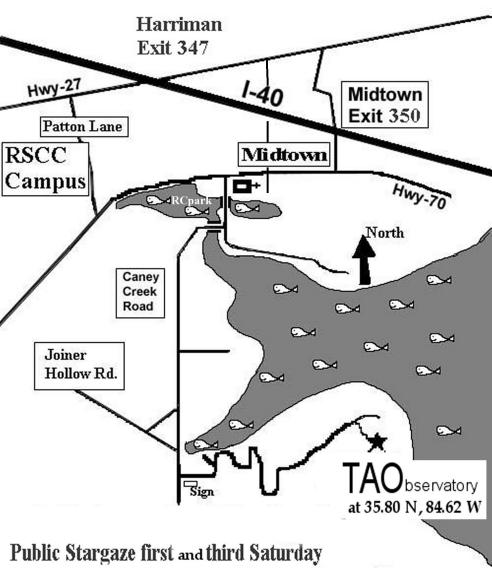
Finding the Observatory The Tamke-Allan Observatory can be found just off Caney Creek Road, in rural Roane County, Tennessee. With reference to the map below, the observatory can be approached from two directions. Those traveling west on I-40, turn off at the Midtown exit, go west on Highway 70 (Kingston Pike) for 3.25 miles to Caney Creek Road (sandwiched between Caney Ford Baptist Church and the Roane County Park). Turn left on Caney Creek Road and go about 1/2 mile south, then turn right over the bridge (Watts Bar Lake). Continue straight ahead (on the blacktop by the curve). At the intersection of Caney Creek Road and Joiner Hollow Road, bear left and go 1000 ft south of the intersection. There, on the left, you will see TVA boat ramp sign and the Roane State Observatory sign (somewhat bent over). Turn left and follow that road up the hill to the classroom and observatory.
|
|